
Land Use/Land Cover (LULC) Mapping & GIS Services
Precision Geospatial Intelligence for Environmental Planning
Spatial data is the foundation of every accurate Environmental Impact Assessment. At San Envirotech, our dedicated GIS and Remote Sensing cell transforms complex satellite imagery into actionable intelligence. With expertise in mapping over 200 project sites, we provide high-resolution geospatial solutions that define project boundaries, identify sensitive receptors, and track environmental changes over time.
NABET Category A Accredited
15+ Years of Experience
Compliance-First Approach
Advanced Scientific Rigor
Our Expertise & Proven Track Record
With a legacy of over 200 completed EIA studies, San Envirotech is recognized for technical precision and regulatory integrity. Our multidisciplinary team ensures every project aligns with the latest MoEF&CC guidelines, facilitating a seamless transition from project conception to obtaining Environmental Clearance (EC).
Our Core GIS & Remote Sensing Services
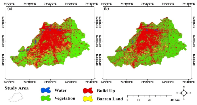
1. Land Use / Land Cover (LULC) Mapping
Using multi-spectral satellite data (such as Sentinel or
Landsat), we create detailed LULC maps to fulfill MoEF&CC requirements.
- Classification:
Categorizing terrain into industrial, agricultural, forest, water bodies,
and settlements.
- Change
Detection: Analyzing historical satellite imagery to show land-use
transitions over the last 10 years.
- Impact
Zone Analysis: Precise mapping of the 10km radius (Study Area) to
identify ecologically sensitive areas.
2. Digital Terrain & Topographic Modeling
- Digital
Elevation Models (DEM): Creating 3D surface models to understand the
site’s topography and drainage patterns.
- Contour
Mapping: Essential for engineering layouts, effluent discharge
planning, and flood risk assessment.
- Watershed
& Drainage Analysis: Identifying natural flow paths to ensure
industrial activities do not interfere with local hydrology.
3. Environmental Sensitivity Mapping
We map critical "No-Go" zones to ensure your
project remains compliant with siting criteria:
- Distance
Buffers: Automated GIS mapping of distances from National Parks,
Sanctuaries, Critically Polluted Areas (CPAs), and Interstate boundaries.
- Coastal
Regulation Zone (CRZ) Mapping: For projects near coastlines, ensuring
compliance with CRZ I, II, III, and IV classifications.
4. Thematic & Buffer Zone Mapping
- Village-Level
Maps: Correlating socio-economic data with geographic locations for Social
Impact Assessments (SIA).
- Greenbelt
Planning: Digitally designing the 33% mandatory greenbelt area to
optimize pollutant absorption based on wind direction and terrain.
Why San Envirotech’s GIS Services Excel?
- Scientific
Accuracy: We use advanced GIS software (ArcGIS/QGIS) integrated with
ground-truthing to ensure that what we see on the satellite matches the
reality on the ground.
- Regulatory
Readiness: Our maps are formatted specifically for EAC/SEAC
presentations, ensuring that spatial data is clear, professional, and
compliant with the EIA Notification 2006.
- High-Resolution
Data: We procure and process high-resolution satellite data to provide
the granular detail required for large-scale Metallurgy, Power, and
Infrastructure projects.
Visualize your project’s
impact with geographic precision.
Request a GIS/Mapping
Consultation